- Home
- GIS Software

What is GIS Software?
Geographic Information System (GIS) software is designed to analyze, display, manage, store, and retrieve all kinds of spatial and geographic data. The system enables you to produce maps and graphs of geographic info for presentation and analysis.Show more This makes it a useful application to visualize spatial data and to create decision support solutions that your organization can utilize. GIS software is leveraged in a wide range of industries including insurance, manufacturing, banking, supply chain, retail, real estate, media, and entertainment. For instance, retail businesses use this system to find the best locations for their outlets. Start by checking our leader Maptitude, and other recommended solutions in this category.Show less
How was this ranking made?
In order to devise this ranking of best GIS Software we have examined 74 trending systems currently present on the market, analyzing their features, how easy are they are to learn, client support, possible integrations and mobile support using our unique SmartScoreTM rating algorithm. This list has been created by Louie Andre, our software expert responsible for the GIS Software category.
List of Top 12 GIS Software
 Order by:
Sponsored
- Sponsored
- Score
Select more products to compare
Compare selected products
1. Maptitude
Our score: 8.5 User satisfaction: 97%Gives you the tools, maps, and demographic data you need to analyze and understand how geography affects you and your business. Businesses can take advantage of demographic and census data provided by Maptitude to map out sales territories and plan more effective marketing strategies.
Select more products to compare
Compare selected products
2. ArcGIS
Our score: 9.6 User satisfaction: 99%A powerful mapping and analytic platform designed for exploring information and sharing location-based insights. Its capabilities include spatial analytics, mapping & visualization, 3D GIS, imagery and remote sensing, real-time GIS, and data collection & management—useful for any type of industry.

Select more products to compare
Compare selected products
3. Mapbox
Our score: 9.5 User satisfaction: 98%Mapbox is a powerful map-making solution intended for developers. It offers a map customization suite called the Mapbox studio, which renders high-resolution maps that respond dynamically and fluidly to scripted events and user input.
Select more products to compare
Compare selected products
4. Trimble TerraSync
Our score: 9.4 User satisfaction: N/ATrimble TerraSysnc is a simple, reliable, and productive platform crafted for fast and efficient GIS data collection and maintenance. It's optimized for proprietary handheld devices with integrated digital cameras, allowing you to capture, preview, and attach images with location metadata.
Select more products to compare
Compare selected products
5. Precisely MapInfo Pro
Our score: 9.2 User satisfaction: N/APrecisely MapInfo Pro is a powerful, simple, and faster desktop GIS software designed for business analysts and GIS engineers. To do so, it offers capabilities like data creation and editing, raster GIS analysis, flexible visualization options, location intelligence suite, and total data compatibility.
Select more products to compare
Compare selected products
6. QGIS
Our score: 9.0 User satisfaction: 99%QGIS is a cross-platform, open source geographic information system designed for viewing, editing, and analyzing geospatial data. This free GIS application enables you to view and overlay vector and raster data in a variety of formats and perform spatial data analysis in spatial databases.
Select more products to compare
Compare selected products
7. CARTO
Our score: 8.9 User satisfaction: 94%An open-source platform with powerful location intelligence and analysis for businesses analysts, data scientists, and individual users. It's built on a drag-and-drop interface that comes with a Data Observatory, which enriches existing location data through relevant and versatile datasets.
Select more products to compare
Compare selected products
8. GRASS GIS
Our score: 8.9 User satisfaction: 97%Open-source and free GIS software with 350+ modules for geospatial analysis and data management, maps and graphics production, multispectral image processing, and more. Available in all major operating systems, it also supports various types of databases and distributed under the GNU GPL license.
Select more products to compare
Compare selected products
9. FME Hub
Our score: 8.8 User satisfaction: 100%Online community for accessing and sharing feature manipulation engine (FME) tools, including transformers, web connections, workspace templates, custom format readers/writers, and more. FMEs help streamline spatial data translation between digital and geometric formats and can be used for various GIS, CAD and raster graphics software.
Select more products to compare
Compare selected products
10. MapViewer
Our score: 8.7 User satisfaction: 100%Thematic mapping and spatial analysis software for creating publication-quality maps and distinguishing trends and patterns in the data. Alongside its flexible map display, advanced analytics, and instant communication, MapViewer is a capable software for any professional that needs to make sense of location-based and spatial data.
Select more products to compare
Compare selected products
11. Geooco
Our score: 6.7 User satisfaction: N/AGeooco is a high-value GPS fleet managements system that is designed to help telematics industry players operate their fleets effectively.
Select more products to compare
Compare selected products
12. Quorum
Our score: 7.0 User satisfaction: N/AQuorum is a robust Geographical Information system (GIS) solution designed to deliver reliable approaches to visualize data in the spatial (map) view.
Order by:
Sponsored
- Sponsored
- Score
- User Score
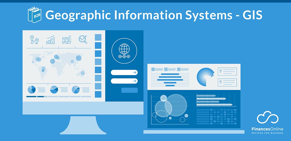
Table of contents
Industry Report - GIS Software for 2022
CloudRank™ system is a unique algorithm that our research team uses to evaluate GIS Software solutions in a detailed and accurate way. The Spring 2022 edition of the ranking was prepared by Louie Andre, our leading expert in the field of GIS Software, who has authored 1380+ product reviews in this category. The goal of CloudRank™ is to present an unbiased, multi-layered perspective on GIS Software, considering a wide range of metrics and factors, and educating potential customers about both opportunities and challenges associated with each piece of software.
In order to achieve full objectivity the position in our CloudRank™ is based on:
- Expert Score: which involves extensive analysis by our internal team which carefully examined all key elements of each software and testing it in real-life situations
- User Score: which involves an aggregated opinion of actual users of each product whose identity was properly verified
- Market Position: which involves general recognition of a given vendor on the market and reflects its overall popularity and reach
What do the tiers in CloudRank™ mean?
We’ve calculated a score for each product based on the average experience shared by our users in their product reviews and arranged the list in three tiers. You can see the methodology below on how the calculations were made.
- Leaders: those with a User Score of 7.7 or higher; this tier includes products that are currently leaders on the market and are appreciated by both experts and actual users. They always represent the best of what the GIS Software market has to offer and are all worth trying out if you’re looking for a reliable solution.
- Contenders: those with a User Score between 6.7 and 7.7; this tier includes high-quality products that still have some minor drawbacks that prevent them from becoming leaders on the market. They always represent well-designed tools that, over time, will most likely develop into market leaders as the missing features are added.
- Rising Stars: those with a User Score between 5.7 and 6.7; this tier includes products that have high-potential but still lack some crucial features or services expected from a leading solution. They are products with solid foundations and a vision that makes us eager to see what they will become as their solution improves in the future.
Regardless of their tier, all products included in our CloudRank™ are popular, quality products considered top-performers by our team of experts. Make sure you read a more detailed review of each solution to find one that will work best for your specific needs and budget.
Show less


MARKET POSITION
A score between 1 and 10 based on popularity and market reach of each product.
TOTAL score
A score between 1 and 10 based on the average of our Expert Score and User Score.
How does CloudRank™ work?
Market Position
A score between 1 and 10 based on popularity and market reach of each product.
Total Score
A score between 1 and 10 based on the average of our Expert Score and User Score.
CloudRank™ tier
Based on product's total score.
Rising Star
Contender
Front Runners
24 Most Popular GIS Software
Here is a list of all 24 GIS Software solutions evaluated with our CloudRank™ analysis. We have compared their features, user satisfaction, market presence and other key factors in an in-depth analysis you can find below:
1. Google Maps API
8.54
Our score and features analysis:
}
CloudRank™
Score:8.54
Score:8.54
Customers company size
No. of employees:
1-10
11-50
51-100
100+
Best features
Worst features
Our score and features analysis:
}
CloudRank™
Score:8.37
Score:8.37
Customers company size
No. of employees:
1-10
11-50
51-100
100+
Best features
Worst features
Our score and features analysis:
}
CloudRank™
Score:7.81
Score:7.81
Customers company size
No. of employees:
1-10
11-50
51-100
100+
Best features
Worst features
Our score and features analysis:
}
CloudRank™
Score:7.81
Score:7.81
Customers company size
No. of employees:
1-10
11-50
51-100
100+
Best features
Worst features
5. Google Earth Pro
7.81
Our score and features analysis:
}
CloudRank™
Score:7.81
Score:7.81
Customers company size
No. of employees:
1-10
11-50
51-100
100+
Best features
Worst features
6. ArcGIS Enterprise
7.77
Our score and features analysis:
}
CloudRank™
Score:7.77
Score:7.77
Customers company size
No. of employees:
1-10
11-50
51-100
100+
Best features
Worst features
Our score and features analysis:
}
CloudRank™
Score:7.53
Score:7.53
Customers company size
No. of employees:
1-10
11-50
51-100
100+
Best features
Worst features
8. AutoCAD Map 3D
7.52
Our score and features analysis:
}
CloudRank™
Score:7.52
Score:7.52
Customers company size
No. of employees:
1-10
11-50
51-100
100+
Best features
Worst features
Our score and features analysis:
}
CloudRank™
Score:7.37
Score:7.37
Customers company size
No. of employees:
1-10
11-50
51-100
100+
Best features
Worst features
10. Bentley Map
7.17
Our score and features analysis:
}
CloudRank™
Score:7.17
Score:7.17
Customers company size
No. of employees:
1-10
11-50
51-100
100+
Best features
Worst features
Our score and features analysis:
}
CloudRank™
Score:7.13
Score:7.13
Customers company size
No. of employees:
1-10
11-50
51-100
100+
Best features
Worst features
12. Oracle Spatial and Graph
7.12
Our score and features analysis:
}
CloudRank™
Score:7.12
Score:7.12
Customers company size
No. of employees:
1-10
11-50
51-100
100+
Best features
Worst features
Our score and features analysis:
}
CloudRank™
Score:7.10
Score:7.10
Customers company size
No. of employees:
1-10
11-50
51-100
100+
Best features
Worst features
14. Precisely MapInfo Pro
7.07
Our score and features analysis:
}
CloudRank™
Score:7.07
Score:7.07
Customers company size
No. of employees:
1-10
11-50
51-100
100+
Best features
Worst features
15. Trimble TerraSync
7.06
Our score and features analysis:
}
CloudRank™
Score:7.06
Score:7.06
Customers company size
No. of employees:
1-10
11-50
51-100
100+
Best features
Worst features
Our score and features analysis:
}
CloudRank™
Score:6.82
Score:6.82
Customers company size
No. of employees:
1-10
11-50
51-100
100+
Best features
Worst features
Our score and features analysis:
}
CloudRank™
Score:6.74
Score:6.74
Customers company size
No. of employees:
1-10
11-50
51-100
100+
Best features
Worst features
Our score and features analysis:
}
CloudRank™
Score:6.67
Score:6.67
Customers company size
No. of employees:
1-10
11-50
51-100
100+
Best features
Worst features
Our score and features analysis:
}
CloudRank™
Score:6.63
Score:6.63
Customers company size
No. of employees:
1-10
11-50
51-100
100+
Best features
Worst features
20. NextBillion.ai
6.60
Our score and features analysis:
}
CloudRank™
Score:6.60
Score:6.60
Customers company size
No. of employees:
1-10
11-50
51-100
100+
Best features
Worst features
Our score and features analysis:
}
CloudRank™
Score:6.41
Score:6.41
Customers company size
No. of employees:
1-10
11-50
51-100
100+
Best features
Worst features
Our score and features analysis:
}
CloudRank™
Score:6.34
Score:6.34
Customers company size
No. of employees:
1-10
11-50
51-100
100+
Best features
Worst features
Our score and features analysis:
}
CloudRank™
Score:6.33
Score:6.33
Customers company size
No. of employees:
1-10
11-50
51-100
100+
Best features
Worst features
Our score and features analysis:
}
CloudRank™
Score:6.31
Score:6.31
Customers company size
No. of employees:
1-10
11-50
51-100
100+
Best features
Worst features
Our report covered 24 most popular products from the GIS Software category. We’ve analyzed their features, performance, integration, customer support, pricing, and several other key buying factors and combined it with feedback from user reviews to come up with the current list of best solutions:
- 2022 GIS Software Leaders: Google Maps API, Esri ArcGIS, Mapbox, FME
- 2022 GIS Software Contenders: Google Earth Pro, ArcGIS Enterprise, QGIS, AutoCAD Map 3D, GRASS GIS, Bentley Map, CARTO, Oracle Spatial and Graph, Azure Maps, Precisely MapInfo Pro, Trimble TerraSync, Surfer, LandVision, Maptitude, GeoExpress, NextBillion.ai
- 2022 GIS Software Rising Stars: Mapline, eSpatial, GeoServer, ZeeMaps
Google Maps is an online mapping platform that lets users see maps in satellite imagery and aerial photos, as well as in interactive Street View. The mapping platform also includes real-time traffic reports as well as route-planning options for traveling via car, bike, public transport or on foot. Google Maps offers advantages for use in business by letting people find and connect with you, increase location visits, and build credibility through reviews.
Google Maps is free to use on the web with a browser or on mobile apps in both Android and iOS platforms. Enterprise use is managed with APIs or SDKs on pricing plans that start as low as $2 per 100 requests. Google Maps can be used with other similar Google products such as Street View, Google Earth, Local Guides, and Google My Business.
Since its initial launch in 2005, Google Maps continues to be used by over a billion people every month. There are also more than five million active apps and websites that use the Google Map Platform. In fact, 86% of people search for business locations on Google Maps.
Most users of GIS Software solutions confirm that in most cases these tools allow them to reach the following business goals:
- It empowers us to improve planning and allocation of resources. [ 86.3% of users ]
- It enables us to enhance efficiency and minimize expenses. [ 86.1% of users ]
- It facilitates effortless recordkeeping. [ 85.5% of users ]
- It helps us to improve our decision making. [ 86.5% of users ]
- Its visual format helps us to improve communication between our departments. [ 86.2% of users ]
How did we select products for this GIS Software report?
The Spring 2022 version of the report includes a total of 24 GIS Software products that were compared and analyzed by our team. We selected them based on the following factors:
- Popularity of a given brand in the SaaS market (based on our own market research)
- How popular a given brand is among FinancesOnline users (based on number of mothly readers for each review page)
- Availability of statistical data generated from user reviews of a particular product (we excluded products with not enough data to draw meaningful conclusions)
- The current listing reflects the state of our database and research as of March 2022. An updated version of the report will be released quarterly to keep data fresh and incorporate information about shifts and changing trends in the market.
What are the current GIS Software trends?
Geospatial data has come a long way in its original use as an aid to map and inventory natural resources. Today, Geographical Information Systems or GIS are used to help predict the weather; manage and automated smart homes, appliances, and buildings; oversee logistics and fleet management; and aid decision-making for smart energy solutions. Here are the current trends impacting the use of GIS in 2022.
Statista
GIS powered by AI and Big Data
Geographic Information Systems generate lots of data. Raw data in and of itself is not useful unless it can be manipulated into granular trends, insights, and patterns from which informed decisions can be made. Combining geospatial data with machine learning, and big data analytics shortens the time required to extract data and use it to augment operational performance.
Big data in GIS is not a new trend. We already see this in action with location analytics for territory mapping to maximize sales opportunities for businesses and map applications that offer alternate routes to get you to your destination in the shortest time possible. GIS has been used to track and monitor outbreaks for the West Nile and Ebola viruses in the previous decade. The Johns Hopkins COVID-19 Dashboard uses ArcGIS to track coronavirus cases globally. Compiling data from 188 countries and regions.
The meeting of GIS and big data has limitless potential applications. The trend is pushed by the lowered costs of hardware and software and an increase in expertise and innovation on the topic. GIS market revenue in the US is projected to reach $2.250 billion in 2025. Some of the challenges emerging from GIS and big data include understanding how to leverage the large streams of data points from disparate sources and how to effectively use it. Another is identifying data scientists and hiring them to apply creative solutions to harness the usefulness of the data
Statista
The Internet of Things leverages GIS
Mentioned in the previous GIS trend, hardware costs for GIS technology has been going down. Along with improved cost-effectivity, technology has also become smaller and more efficient in data collection. The miniaturization of devices and sensors with interconnectivity has led to wider spread use of the Internet of Things (IoT). Conservative estimates put the number of active connected devices in 2019 at 27 billion.
Use cases for GIS and IoT include an increase in self-driving vehicles, creating a safer space for road travel; drones and unmanned aerial vehicles (UAV) applications can be used for agricultural crop management, search and rescue in times of disasters, or mitigate crime. IoT use is increasingly embraced with the US ranking first among 79 countries in Huawei’s Global Connectivity Index of 2019. The US also leads in spending and IoT deployment with $194 billion with China trailing a close second with $182 billion.
Coordination/clash detection Visualization Project planning Estimating Visual mock-ups Prefabrication Selling/presentations Take-offs Scheduling Value analysis Code compliance Facility management other JBKnowledge
Purpose of BIM use in the US construction sector in 2019
Purpose of BIM use in the US construction sector in 2019
Coordination/clash detection: 60.5
Purpose of BIM use in the US construction sector in 2019
Visualization: 49
Purpose of BIM use in the US construction sector in 2019
Project planning: 46.5
Purpose of BIM use in the US construction sector in 2019
Estimating: 38.3
Purpose of BIM use in the US construction sector in 2019
Visual mock-ups: 36.1
Purpose of BIM use in the US construction sector in 2019
Prefabrication: 33.4
Purpose of BIM use in the US construction sector in 2019
Selling/presentations: 33
Purpose of BIM use in the US construction sector in 2019
Take-offs: 32.7
Purpose of BIM use in the US construction sector in 2019
Scheduling: 28.5
Purpose of BIM use in the US construction sector in 2019
Value analysis: 11.7
Purpose of BIM use in the US construction sector in 2019
Code compliance: 11.2
Purpose of BIM use in the US construction sector in 2019
Facility management: 10.3
Purpose of BIM use in the US construction sector in 2019
other: 15.9
The union of BIM and GIS
Geospatial data enriches Building Information Modeling (BIM). Going beyond the obvious of mapping out the terrain prior to construction, GIS-enabled BIM technology provides the architectural, engineering, and construction team a complete bird’s eye view of the project. The design process becomes alive with AR and VR capabilities. Giving more spatial awareness for the design process, meet compliance metrics and budget estimates.
Decisions can be made about possible setbacks because the project looks beyond design and functionality but also takes into account the whole construction decision-making process. This shortens the construction lifecycle, increasing project efficiency, and cost-effectivity.
GIS -assisted BIM technology can also be used in creating indoor maps for complex buildings. Interactive layouts with all entry and exit points clearly mapped out are useful for emergency responders in times of calamities and possible terror attacks.
GIS software helps to visualize spatial and geographic data and enables you to create easy-to-understand charts and graphs. Therefore, it finds use in a wide range of industries. However, it can be confusing to select the best GIS software for your specific business needs from the plethora of desktop and cloud-based applications out there. We help you do knowledgeable comparisons and make the right selection by giving you pointers on the key features and benefits to look for.
Get to Know Each Product with Free Trial
The best GIS software vendors offer a free trial to enable you to get acquainted with the software’s tools and find out if they match your needs. Therefore, do your homework and shortlist suitable solutions in this category. On our part, we recommend you try out ArcGIS, SuperGIS Desktop, Simple GIS Client, Bentley Map, and Maptitude.
Targeted Businesses
Geographic information tools are used by government agencies, businesses in many industries, land use planners, health organizations, environmental scientists, research institutions, communities, indigenous people, and others.
Examples of GIS Software
- ArcGIS: A cloud-based mapping solution. It offers robust yet simple online mapping tools that can be utilized even by lay users to create and share attractive maps. Besides maps, you can also use ArcGIS Online for collaboration, administration, and analytics. On top of that, this platform offers unique capabilities for using location-based analysis to improve your business.
- SuperGIS Desktop: A robust desktop GIS software that gives you the capabilities to analyze, visualize, manage, and edit geographic data. Then, you can exhibit the results on progressional-quality maps. It is easy to customize the application’s various functions for your needs. Plus, the platform supports various data types and offers sophisticated data processing tools.
- Simple GIS Client: A feature-packed GIS software platform that runs on MS Windows. Besides desktop, it is lightweight enough to be used on Windows tablets and laptops for tasks such as trip planning and field data collection. This app is recommended for editing and viewing shapefiles as it supports multi-user write and read access to shapefiles. The vendor offers a 30-day free trial.
- Bentley Map: 2D/3D desktop mapping and GIS software. You can create, maintain, share, and analyze your business, engineering, and geospatial data in a MicroStation environment. Offers a flexible yet strong application program interface (API) to help you build custom GIS applications. Use the mobile app to enhance the productivity of your field staff.
- Maptitude: A mapping software product from Caliper Corporation that allows you to view, integrate, and edit maps. It is an easy-to-use package that helps you enjoy the benefits of spatial analysis and desktop mapping. Maptitude tells you where your consumers are and find out where sales are maximum. On top of that, you can discover hidden opportunities and get answers to geographic questions that affect your operations.
Types of GIS Software
Geographic information tools can be classified into the following types:
- Open source GIS
- Web GIS
- Desktop GIS
- CAD GIS
- Business mapping
- GIS complements
- Mobile GIS
- General purpose GIS
Key Features of GIS Software
- Routing tools – These give the ability to design accurate stops and to manage, compare, and manipulate routes.
- Territory tools – Businesses need territory creation tools that help to handle data tables and to visually represent and manipulate service areas.
- Reports – Top GIS software applications enable you to intuitively and quickly create top quality reports in PDF and MS Excel file formats.
- Interoperability – Quality GIS platforms support the most recent data standards and a range of file formats including those for MS Excel, MS MapPoint, and Google Maps.
- Data – On top of that, they provide new data sets for different countries with access to the latest available geographic information.
- Logistics and Operations – A distance and drive-time feature that creates an Excel table showing the costs of travel between any number of locations. You can quickly find out the nearest and backup locations ranked by distance or travel time.
- Location analysis – This technique is used to identify ideal locations for new retail outlets.
Benefits of GIS Software
- Decision making is improved because you get detailed as well as specific information about locations.
- You can increase efficiency and reduce expenses especially regarding scheduling timetables, fleet movements, and maintenance schedules.
- The visual format is easy to understand which helps to enhance communication between involved departments or organizations.
- GIS software enables effortless recordkeeping as it easily records geographical changes.
- Helps in geographic management as you can get to know what is happening in a geographic location and space, and use it to plan actions.
- Cloud GIS software solutions facilitate instantaneous collaboration.
- Offers enhanced transparency for citizen engagement.
- Enables identification of underserved and at-risk populations in a community.
- Helps in planning and allocation of resources.
- Improves management of natural resources.
- Enhances communication during a crisis.
- Finally, GIS software can be used to plan for the impact of demographic changes in a community.
Latest Trends
Location as a Service
In the past, GIS was mostly used by oil and gas, utilities, telecommunications, and government sectors. This is changing and today tech companies and large retailers are enjoying the benefits of understanding and using geospatial data. The basics of GIS and its uses have improved significantly. Now, it is the age of services-based GIS. GIS professionals are connecting directly with consumers using web-based platforms that offer visualizations that are easy to access and understand.
Sophisticated Analytics
Businesses that place importance on location can benefit from spatial analysis. For example, geospatial analysis is useful for site selection. Retailers that want to launch new stores need information on hospitable demographics as well as on similar ventures that have proved to be successful. This information can be loaded on a map in order to do statistical analysis which can help to make decisions about the locations of new stores. Maps are easy to understand and GIS professionals can use web-based services to create charts, graphs, and maps, and effortlessly perform analytics.
Potential Issues
A recent survey by GIS Professional throws light on the issues faced by users of GIS software. In the survey, 32% identified data accuracy and 31% named efficient data management as main challenges. In addition, 12% named open source and open data as both a trend and a challenge. 8% named location privacy as an issue to be wary about.
The respondents also identified two other concerns: the high cost of proprietary software solutions and the use of GIS by people who do not have a proper understanding of the technology. The availability of open source data and software is creating new users who understand the advantages of GIS but lack the knowledge to use the system properly. This lay user group opens up a new market for GIS software vendors. However, these providers need to compete with free open source GIS alternatives that are preferred by companies that wish to reduce costs.
Useful Stats
- The GIS industry is worth US$ 8.1 billion in 2020.
- It’s growing at a CAGR of 12.4%.
- The APAC region is the biggest driver of GIS industry growth, thanks to urban planning and smart cities in China and Japan.
- Navigation is the biggest usage segment of GIS data.
- Two of the top 3 key players in the GIS industry are Chinese.
Where Is GIS Data Useful?
- Retail. Businesses in the retail industry use geographic information systems to find the perfect spot to erect a new store. Meanwhile, marketers use GIS data to identify which areas need a specific type of marketing and which stores can be tapped for maximum impact. Supply-chain departments can also use GIS to plan optimum routes and times for logistics.
- Engineering. GIS provides data for the establishment of communication network towers, power plants, and other public utility infrastructures like roads, rails, and waterways.
- Science. Biologists use GIS to monitor animal migration and study them even while they’re on the move. Geologists can map out geographical features for natural resource management, such as for prospecting in mining. Marine ecologists also use it to look at marine ecosystems and oceanographic charting.
- Disaster management. Governments worldwide use GIS to formulate an effective response to natural disasters, like earthquakes or hurricanes. Meteorologists also use GIS data to spot and forecast climate and weather patterns, mitigating the cost of a disaster.
List of GIS Software Companies
Order by:
Newest
- Newest
- Score
- User Score
Product name:
Category:
Smart Score:
Price:
User Satisf.
User reviews:
Things to consider when you invest in a SaaS
To pick a suitable SaaS program for your business, start by asking the following questions:
· Is this cloud system the best product—economically and features-wise?
· Will it be uncomplicated to do long-term business with the cloud vendor?
· Is the solution easy to use and does it simplify technology?
· Can the software help your organization to handle compliance, security, and operational risks?
Find out if other companies have successfully implemented the solution. Get proof about the provider being able to provide the desired business value and ROI. Browse case studies to learn about the user experiences of other buyers. Get references from the vendor and find out about the quality of the software and service provided.
Another important aspect to consider is the free trial. Before you make such a crucial decision and shell out your hard-earned money, be certain if the program actually fits your requirements. You can do this by signing up for the free trial and checking out the program’s functionality. Also, find out if the vendor can help you to pilot the platform. You may need to pay for the implementation of the pilot, but the cost is worth it as it will give you results and proof points to analyze before you make a key investment.
Frequently asked questions about GIS Software
What is the best GIS sofwtare?
The best GIS is ArcGIS. It’s a robust geographical information system that uses maps for data extrapolation and analysis. It has powerful analytics for businesses to explore information and share insights, with complete contextual tools regarding spatial reasoning and mapping for any kind of industry.
What are the benefits of GIS software?
- Improved decision-making. You improve decision-making by using data from GIS to back it up.
- Enhanced efficiency. GIS data can increase efficiency by reducing time and money spent on things like scheduling timetables, fleet movements, and maintenance schedules.
- Conservation. Especially useful for the sciences, as GIS can aid in the management and husbandry of natural of resources.
- Mitigates disaster and demographic impact. GIS enables identification of underserved and at-risk populations in a community. Finally, GIS software can be used to plan for the impact of demographic changes in a community and mitigate risk in case of natural disasters.
What are the features of GIS software?
Data. GIS provides new data sets for different countries with access to the latest available geographic information.
Territory. Businesses need territory creation tools that help to handle data tables and to visually represent and manipulate service areas.
Routing. These give the ability to design accurate stops and to manage, compare, and manipulate routes.
Logistics. A distance and drive-time feature that creates an Excel table that shows the costs of travel between any numbers of locations. You can quickly find out the nearest and backup locations ranked by distance or travel time.
Reports. Top GIS software applications enable you to intuitively and quickly create top quality reports in PDF and MS Excel file formats.
Interoperability. Quality GIS platforms support the most recent data standards and a range of file formats including those for MS Excel, MS MapPoint, and Google Maps.
What is the easiest GIS software to use?
- ArcGIS. The best GIS software is also the easiest to use (and learn). Its mapping features are top-notch for research and educational purposes. Its capabilities can even be extended by a custom programming extension powered by Python.
- MapBox. MapBox is a map creation software whose claim to fame is its easy integration. MapBox contains a variety of APIs so you can integrate it with functions, like routing, presented in a way that you can build innovative functions out of.
- QGIS. QGIS isn’t just free but it’s also easy to use. Its user interface is one of the most user-friendly of its kind. It’s also compatible with a lot of database formats and even a competing GIS, ArcGis.
What is a good free GIS software?
- QGIS. QGIS is a cross-platform, user-friendly open-source geographic information system designed for viewing, editing, and analyzing geospatial data. This platform can handle multiple database formats and functionalities.
- GRASS GIS. An OSGeo project, the platform works well for academic institutes and various commercial settings around the globe. Environmental consulting companies and government agencies can also take advantage of the open-source software to analyze location-based data and manage it efficiently.
- FME Hub. FME Hub provides access to a variety of FME tools and a platform that anyone can use for their projects, including spatial and cartographic data. It’s a convenient and secure platform to store and reuse connected services.

Updated